
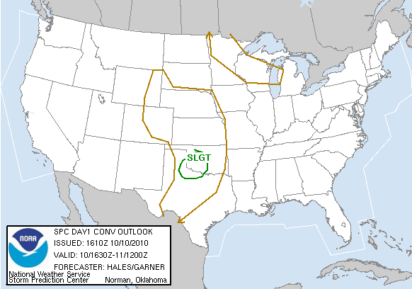
SPC Day 1 Convective Outlook. Slight Risk
Yesterday we had some unseasonal weather erupt over western north Texas and Oklahoma. An upper level storm system was moving to the south/south east into southern KS and OK. A stationary front developed over western OK and the TX panhandle. Weak instability limited the amount of severe weather and despite the meager dewpoints (55+) we still had severe weather. Storms fired up along the stationary front and moved in the moisture/instability axis, intensifying as they fed off the moisture. Anadarko got hit with an incredible hail storm. Around 6:00 I left work and headed out for Quanah, TX. An isolated severe thunderstorm developed and was moving at only 20kts. I caught up to the storm just before sunset, but after sundown is when the real show began. I was able to capture an intense CG lightning barrage. See the report below.
Thanks for the support.
-Ben

SPC tornado graphic for Day 1. Not how there is no outlined area. With the lack of deep moisture and strong instability there wasn't much of a tornado threat.

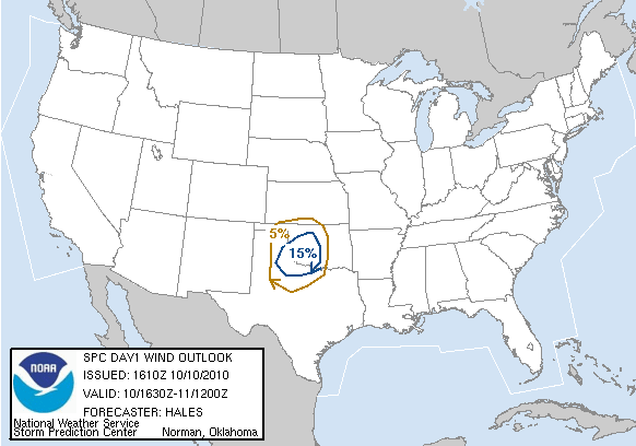
Hail and wind was another story, however. SPC Hail and Wind Day 1 outlook.

Around 3:00 the SPC issued a mesoscale discussion for western north TX and OK. Shortly after, a severe thunderstorm watch was issued.

Severe thunderstorm in Foard county. I am all the way back in Wichita Falls. Its about 6:30 and the sun sets around 7:30. The storm is a little over 80 miles away.

I do a little driving and I make it to Vernon, TX. The sun is fixing to set so I pull over to shoot some distant structure shots.

This was probably a very nice looking updraft on this storm, but sadly I am unable to capture it during the daylight.

The sun goes down, but the sky is just as bright! This storm was very electric.


Beautiful branching on these CG lightning strikes.

By far my favorite from this day.

Here you can see the updraft base (background) and a little structure on this storm.

Updraft base and heavy rain/hail core (to the right).

Looking at the radar we see a nice looking hook echo. The RFD was strong with this storm. As the storm occludes a few downbursts occur.

Downburst! Watching how quickly the rain was moving, I estimated around 60mph. You can see the rain fall back in the updraft base.

More insane CG lightning.


I closed the shutter a little too quickly in this one. These are the negative leaders that are trying to make contact. I missed the positive return strike.
No comments:
Post a Comment