I have lived in Texas all my life, and no other subject has filled me with both fear and awe at the same time like Texas storms do. This powerful weather phenomenon has always inspired me. The storms themselves are a work of art. Powerful winds aloft sculpt the towers into magnificent shapes and structures. Lightning lights up the night sky like an Independence Day celebration, and the booming thunder seems to echo forever. All of these factors are orchestrated like a symphony in the heavens. “Majestic Noise” is the name of this performance, and I am its audience. I love photographing and experiencing these storms. It is my passion, my calling, and my mission. When the severe weather rolls in, I go out to listen for that “Majestic Noise!”

Sunday, October 24, 2010

10/22 Chase Report...

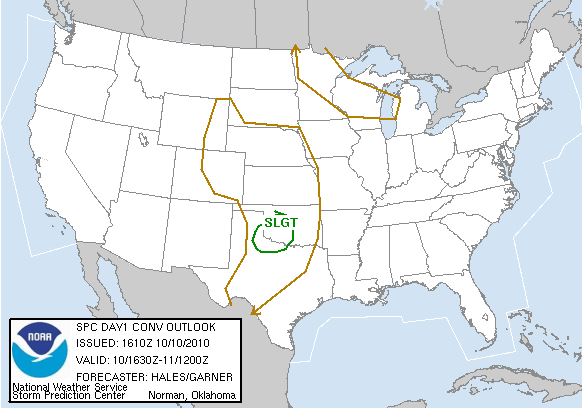
SPC Day 1 Outlook. Slight risk over TX, OK, and KS.

There is just something about the last chase of the year. It motivates us to get out there and witness what mother nature can do. October 22 is probably our last chase for this year and it was well worth it. A strong midlevel jet was maxing out right over western north Texas during the peak heating hours. Strong curving in hodographs showed rotation in the lowest 0-6km of the atmosphere. Lingering precipitation/cloud cover limited sunshine and decreased instability. There were a few breaks in the clouds and thunderstorms fired up in western north Texas. I coordinated with James Langford and Zack Biggs to meet up in Wichita Falls and we chased together. It always nice when its  a local "backyard" chase. It was an excellent chase, as we intercepted a few supercells. Check out the full report down below.

Thanks for the support.

-Ben

SPC Tornado graphic for Day 1. We had awesome shear with these storms, but due to the lack of instability and cold air constantly undercutting the updrafts we did not see any tornadoes.

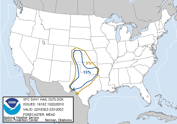
SPC Hail graphic for Day 1.
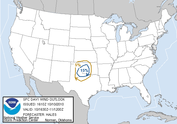
SPC Wind graphic for Day 1.

Thunderstorms with explosive development over Knox and Haskell counties. Note how I am back in Wichita Falls. I was waiting for James and Zack to arrive.

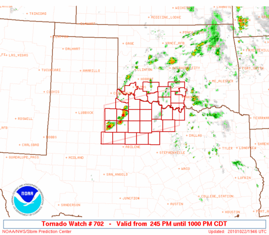
Tornado watch issued for target area.
I meet up with James and Zack and we get out of Wichita Falls on Highway US 277 S and turn on Highway 25 to head north towards Electra, TX. Both storms have a hook appearance to them.

So our northern cell begins to wither away and the southern cell explodes (this is what happens during the entire chase) our next goal is to go back out of Mankins, TX, hook back up on 277, then go north on 183. Luckily the storms were moving at reasonable speeds and we blast our way on 183 to intercept.

Radar image as we turn on 183. The storm is intensifying and is maintaining the hook appearance.

On our way north on 183. You can see the mesocyclone/wall cloud as well as a beaver tail going into the storm.

Still driving on 183 the storm starts to look better and better. Its around this time that we actually witness a few possible funnels (one of which I captured on video).

We find a nice place to pull over and watch as the storm puts on a show for us.

This storm had some great structure on it.


So our main storm starts to dies out and a new cell develops just to our west. The lowering on this storm, while impressive looking, was not rotating. The cell to our southwest starts to become the more dominant storm. We leave 183 and head back on 277 to get in position for the storm.

We are in an excellent spot for some photography. No power lines or nothing.

More great structure on this storm.

This is a capture of the storms anvil (left portion of the photo). You can see the edges a very sharp. This updraft was moving some serious air!

This storm's wall cloud was rotating albeit fairly slow, it did have some incredible rising motion in it, however.

Radar image of our location in position to the storm.

The storms updraft base passes just to our northeast and shortly after the RFD.

The storm is occluding and we need to get to the northeast.

What? The TIV II out on a chase in October? We were actually quite surprised that there were some many chasers out on this storm. We expected everyone to target the triple point in western KS.

We had back east on 277 and watch as this storm occludes itself. But to our surprise another cell forms the south and actually doesn't look bad--visually.

New supercell to our southwest.

The storm is starting to approach us...

Incredible sunset with some awesome colors!

What is left of our northern cell is bathed in the pinkish light from the sunset.

It was just a great chase. We saw a few supercells, met some other chasers, and got some great photos. I would call it a success. To see more from this chase watch the video down below.

Wednesday, October 20, 2010

Rain, Rain Go Away: A Forecast Update...

I was just looking over the 00z NAM to see how the models are playing Friday out. So far we've got excellent vertical/directional shear and good moisture return. However, something that has me worried about this setup (and was mentioned in my earlier post) is the lingering precipitation over the target area. So storms are going to push through TX/OK late Thurs night into Fri morning (most likely forming an MCS). But as this storm system approaches lift will generate showers/thunderstorms throughout the morning into afternoon. This precipitation can stabilize the environment which can limit instability.

 00z WRF/NAM 6hr Precipitation graphic for 18z (1p.m.) Friday.
ML CAPE for 18z Friday. The precipitation is stabilizing the target area, thus low values of instability are expected.

Now does this mean I will be sitting Friday out? Heck no! This just means that there are some obstacles to overcome before we see any severe weather. If there can be a break in the cloud cover where some areas can get some good ol' sunshine, maybe we can see ML CAPE values closer to 1500 J/kg. Then we would be in business. This is too good of a setup and too close not to chase. Not to mention I have the day off! So everyone keep your fingers crossed and think "sunny skies'!

Be sure to subscribe/follow so you can get the latest updates.

-Ben

Sunday, October 17, 2010

Monday's Forecast Falls Through, Hopes for this Weekend...

SPC Outlook for Monday. No severe thunderstorms are forecast.

So it looks like the forecast for Monday fell through. The NAM is showing the storm system hanging out farther west.  
 The lack of upper level winds will limit the severe potential for Monday. You can see the storm system out in the west coast of CA.

Another turn off is the general lack of instability and a stout cap.

 Probably the only thing that will spawn off thunderstorms is the cold front that is forecast to move through the area. I am looking forward to the fall temperatures that it is supposed to bring, however.

There are some higher hopes for Friday, however. The GFS is showing a low pressure trough digging into the TX panhandle/western OK around 18z. Upper level support is better with this system and the combination of A sharpening dryline, moderate instability, and a mild cap are a good sign. It is still a little far off, but I have confidence in this system.

 500mb chart for 18z Friday.

 Surface temps and wind for 7p.m. Friday.

 Nice dryline setting up right over the TX/OK border.
CAPE chart for Friday (18z). There is also a relatively weak cap in place over the area.

I hope these next few model runs will slow down the progress of this system. If it moves too far east, then we could see storms fire up east of I-35. I usually try to stay away from that area, the road networks aren't that great and there are more trees and hills there as well. The good news is that I have Friday off, but I was hoping for more of a "local" chase. Will keep y'all updated.

Thanks.

-Ben


Wednesday, October 13, 2010

Another Chase Next Week?...

It appears we could have ourselves another chase day next week. I am really enjoying these out of season chases. Read on to learn more about this forecast.

 H5 (500mb) charts for 12z Monday (10/18). The wave set off from this trough if forecast to move through TX/OK by 00z.

Forecast 10/18/10:

A possible chase day is appearing on the recent model runs. A trough of low pressure over the western stated will eject a wave through the TX panhandle and western OK. In addition a surface low will develop in the TX panhandle. With adequate surface heating and moisture return, the CAPE values should be in the 1000 J/kg range. The lift from the trough and low should be sufficient for thunderstorm development. There are a few things I am concerned about, however. First the lack of stornger winds aloft. We're currently looking at around 15kts bulk shear. Secondly, the cap could also be an issue H7 temps around 7 degrees celsius and CINH around -150 J/kg. Any storms that do develop will be near the surface low. Lastly, it is a Monday and I'm not too sure if I will have that day off, we'll just have to keep an eye on this.

 00z Surface temps in the upper 70's over most of the target area, and the low in the TX panhandle/OK border.
 Moisture return is not going to be an issue here. GFS is showing a decent dryline cutting off most of the TX panhandle. Dp's in the 60's are expected over the forecast area.

 A nice instability axis sets up OK/TX. MLCAPE values 1100 J/kg.

A stout looking cap is also over this area. Lack of surface heating and deep moisture could prevent thunderstorm development. CINH values of -150J/kg.

Monday, October 11, 2010

10/10/10 Chase...

 SPC Day 1 Convective Outlook. Slight Risk


Yesterday we had some unseasonal weather erupt over western north Texas and Oklahoma. An upper level storm system was moving to the south/south east into southern KS and OK. A stationary front developed over western OK and the TX panhandle. Weak instability limited the amount of severe weather and despite the meager dewpoints (55+) we still had severe weather. Storms fired up along the stationary front and moved in the moisture/instability axis, intensifying as they fed off the moisture. Anadarko got hit with an incredible hail storm. Around 6:00 I left work and headed out for Quanah, TX. An isolated severe thunderstorm developed and was moving at only 20kts. I caught up to the storm just before sunset, but after sundown is when the real show began. I was able to capture an intense CG lightning barrage. See the report below.

Thanks for the support.

-Ben


 SPC tornado graphic for Day 1. Not how there is no outlined area. With the lack of deep moisture and strong instability there wasn't much of a tornado threat.


 Hail and wind was another story, however. SPC Hail and Wind Day 1 outlook.

 Around 3:00 the SPC issued a mesoscale discussion for western north TX and OK. Shortly after, a severe thunderstorm watch was issued.
 Severe thunderstorm in Foard county. I am all the way back in Wichita Falls. Its about 6:30 and the sun sets around 7:30. The storm is a little over 80 miles away.

 I do a little driving and I make it to Vernon, TX. The sun is fixing to set so I pull over to shoot some distant structure shots.

 This was probably a very nice looking updraft on this storm, but sadly I am unable to capture it during the daylight.

 The sun goes down, but the sky is just as bright! This storm was very electric.


 Beautiful branching on these CG lightning strikes.

 By far my favorite from this day.

 Here you can see the updraft base (background) and a little structure on this storm.

Updraft base and heavy rain/hail core (to the right).

 Looking at the radar we see a nice looking hook echo. The RFD was strong with this storm. As the storm occludes a few downbursts occur.

 Downburst! Watching how quickly the rain was moving, I estimated around 60mph. You can see the rain fall back in the updraft base.

 More insane CG lightning.


 I closed the shutter a little too quickly in this one. These are the negative leaders that are trying to make contact. I missed the positive return strike.