
 |
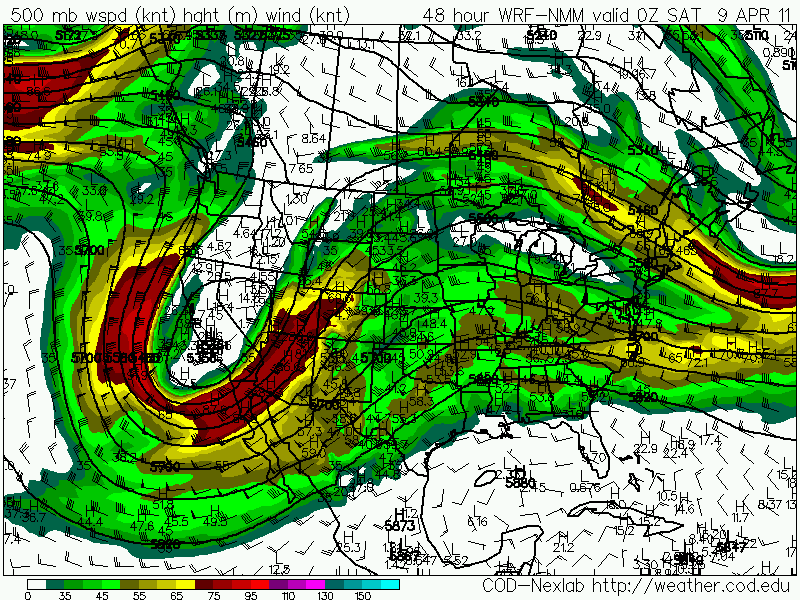
| Saturday 00z placement of the upper level storm system. |
After a couple of busts earlier this season, 2011 looks to be underway. I plan to be chasing on Friday. This looks to be the best setup I've seen for the southern plains all year. Read on to learn more about this forecast.
Thanks.
-Ben
This upper level storm system is going to be hanging around a few days. While it makes it's way along the southern plains thunderstorms are expected starting as early as Thursday.

Hodograph for Gainsville, TX. The impressive right curvature of the hodo indicates an environment favorable for supercells.

Closer look at the Southern Plains on a 500mb chart. Bulk shear should be around 40kts, which is good for severe weather.

Surface temperature for 00z Saturday (7pm Friday). Temperatures are going to be in the 90's over the warm sector.

A modest LLJ will help bring in deeper moisture, something that I have been concerned with for sometime.

Surface dewpoints are reaching in the 60's which is sufficient for severe weather.

This will create a very unstable atmosphere over the target area. 3000 J/kg of CAPE!

A strong cap will be in place throughout most of the afternoon. This will suppress thunderstorm development, this has been a major problem so far this season.

But the models show the CINH breaking up around 00z. This will hopeful spawn off a few isolated cells instead of a giant squall line. If an isolated storm develops it will be in an area favorable for supercells and possibly tornadoes.

The models are also showing precipitation breaking out around 7pm. The best part is the target area is much closer to home this time.

The Storm Prediction Center has already issued a SLIGHT risk area for KS, OK, and TX.
I am very excited about this day and I look forward to a great chase. Follow along with us by visiting my live stream page here (the password is "majesticnoise").
No comments:
Post a Comment